So for today’s examples of the AI mess, recently I was in Ban Pong near Phayao. A couple of times my GPS showed me the main 1193 hwy seemes off from the true position. Back on the Computer, and with the benefit of multiple GPS traces and newer imagery, we can see that the Bing image it was traced from is “off”, but the newer DG-Std image is correctly aligned.
However, I also see mass of residential roads have been added by Micheal (VLD011) without checking for image alignment, so now in addition to the Hwy, now we have to correct all those.
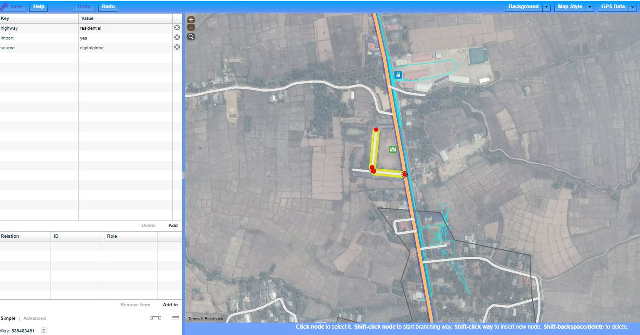
Furthermore, in just that one screenshot above, working downwards, I see …
1/. The road below the fuel station is actually a track leading to fields. Thats a market above it, not a house.
2/. The school on the left has its access road draw as residential, and for some reason, does not continue in a loop back to the road. Local mappers would know this and draw it as a service road, with some even adding a permissive tag.
3/. Further down on the left, we see a residential loop going around the back of the village Health Centre… of course, this would also be a service road. The health centre is not, and does not look like a house, and besides, the access road passes across the front of the building too … guess the AI missed that one.
4/. And opposite the health centre, we have the District Office … also marked as residential and with only one section of the access road drawn… in reality its a loop, and of course should be service road.
So my point yet again is … if in one small area, we find so much bad mapping, just how much damage has been done to the whole of the Thailand Map. Corrections that local mappers will never have the time to rectify.
I will also send this post to the team osm@fb.com, but please, I have not got time to comment to individuals, or post in every changeset affected as some OSM purists might suggest.
I can spend an hour a day flagging these issues, or get on with the more worthwhile job of inputting data. I know the DWG sees these posts so please, how do we go about reversing all the “imported roads” so as we local mappers, at least have a chance to enter the data in correctly. Can someone help me write a script that deletes all roads marked as import=yes ?