I’ve wanted to revive the old TIGER maps for a while and have managed to cobble something together. The goal is to have a set of layers that make it easier for us to make progress on the longstanding TIGER menace.
The site has 7 overlay layers available but I would love to add anything folks find useful.
tiger:reviewed=no - All items with this key=value. The work to be done.
addr:housenumber - All items with this key=value. Areas where there may be corroborating evidence for roadway names.
tiger railway - All items with tiger:reviewed=no and railway=rail.
tiger pipeline - All items with tiger:reviewed=no and man_made=pipeline.
National Address Database - A rough map of where information exists in the National Address Database data file. This is useful for finding places where you can use NAD to do name review. I have documented my own technique in this diary entry.
redlined - The set of neighborhoods that were historically redlined.
Eclipse 2024 - The centerline and penumbra path for the 2024 total solar eclipse.
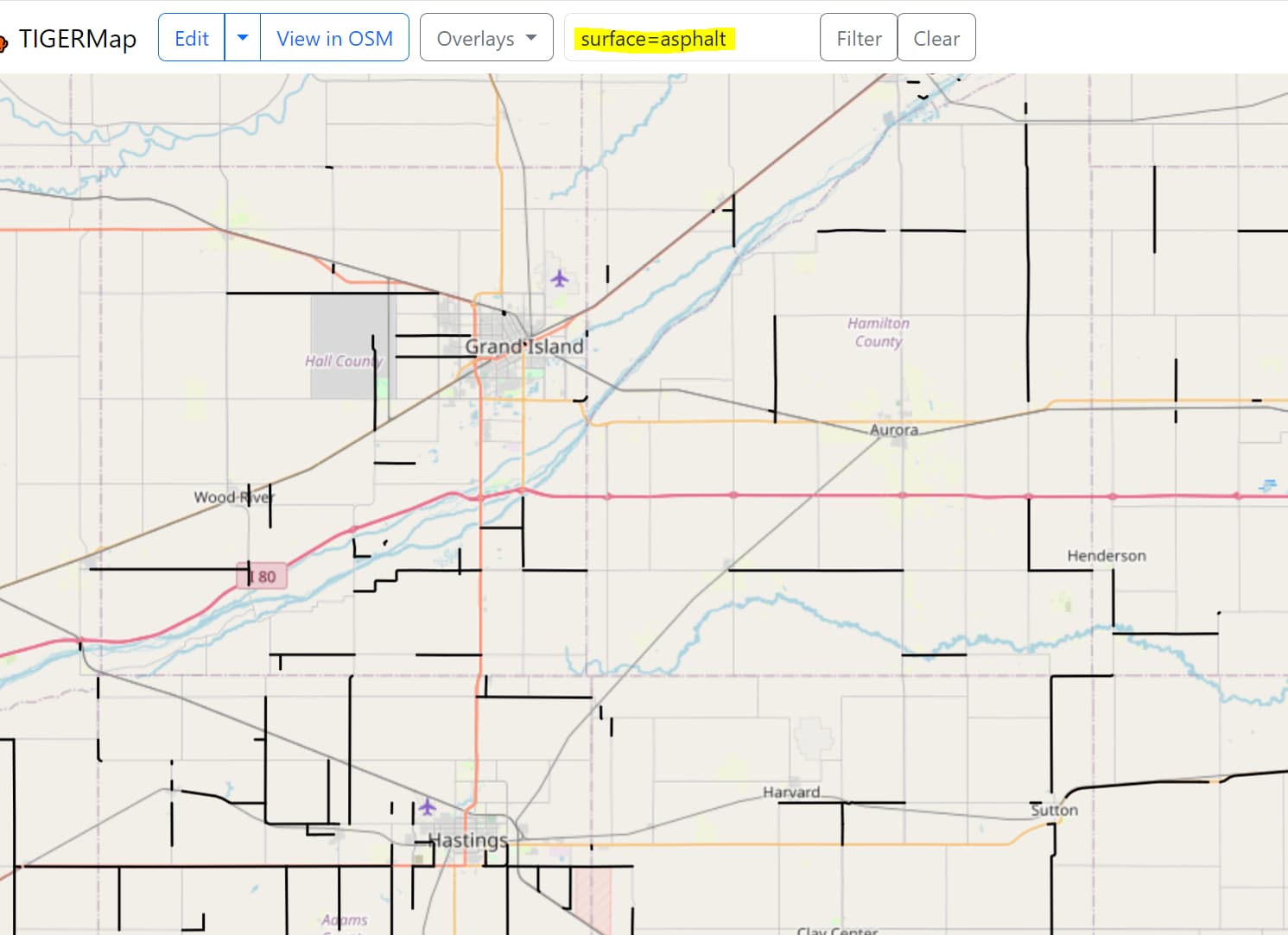
@Richard I was thinking about adding an “all navigable ways tagged with surface=” layer. Which set of tags should I look for in conjunction? Presumably highway/cycleway/footway? Are there values surface that should be excluded? Only a few to include?
I like it. I see a few roads that I’ve definitely reviewed many times, that still have the tag tiger:reviewed=no. It’s helpful to identify those so I can immediately go remove the tiger:reviewed tag, as well as identify other nearby ones that really haven’t been reviewed.
@watmilldon, I thank you mightily for creating the railway=rail toggle: I like it, too!
It is (or could be?) a much nicer “panable, zoomable” map experience (especially with those smooth-zooming vector tiles!) compared to the simple Overpass Turbo (OT) queries I’m doing now, if it were clear to me what, exactly, this map displays. Our United States/Railroads - OpenStreetMap Wiki has an OT query for the state of Rhode Island (it is small and a relatively light load on the OT servers) which differs from the display of this view. This leaves me confused about what your “toggle” does.
That OT link is straightforward: it displays tiger_reviewed:no tags in a geocoded area. But I’m not sure what is displayed as I turn on your “tiger railway” toggle. (Compare the two in Rhode Island, as I have and see if your forehead doesn’t wrinkle with inquisitiveness or even confusion). I ask you to please elaborate on what is displayed with your toggle, or perhaps we could fine tune the behavior to match rail mappers’ expectations when cleaning up non-reviewed TIGER rail? Thank you in advance.
That toggle should be “all ways that are railway=rail and tiger:reviewed=no”. I think there’s 2 things happening.
the color I picked for railways is way too similar to other roadway colors in the base layer. I have changed it to blue
at lower zooms the “smaller” segments are dropped which means, for some areas, you have to zoom in a bit to see them
I have been thinking about switching to a greyscale base layer for a bit which will help unclutter the styling. I will probably flip to that when I add the more general filtering functionality.
For the second item, I can play around a bit with the tile generator options but I don’t have a great solution at the moment.
Yes, just like ORM (which defaults to Carto-greyscale, but gives the option for Carto in its usual colors) it would be helpful if your basemap layer were displayed in greyscale, then blue for non-reviewed TIGER rail. Neat-o and thanks again.
When these ways were imported, were they all originally highway=residential? Or were some of them highway=track? Would anything not residential or track have to have been modified at some point?
I’ve been noticing a lot of highway=service and access=private, that were like that since the initial TIGER import. I’ll add service=driveway if it’s a driveway. If not, sometimes it can stay as highway=service, or sometimes it’s really highway=residential and the “private” can be removed. Definitely needs to be removed if it’s a public road with its own street name. I tend not to put “private” on driveways, but I’ll leave it on if it’s already on it. The way I see it, a driveway serves only one or two houses, and there’s no need for anyone to go up there if they’re not visiting the house, so it seems redundant to add the “private” tag. To me, the “private” tag seems useful for service roads that serve several houses, but are not public roads.
Unless there is a sign or gate that clearly restricts access, I recommend changing access=private to ownership=private. More explanation here: Tag:access=private - OpenStreetMap Wiki
Thank you for that. I’ve never seen that page before, but I’ll read through it and be aware of the intended meaning for “private” while working with driveways and such.
The site now has a data overlay showing areas covered by the National Address Database. This is most useful for finding places where you can use NAD to do name review. I have documented my own technique in this diary entry.
Thank you @watmildon!!! I will use this on my eclipse voyage next month, possibly the last one for a while But euro/asian/australians folks will have more opportunities to see eclipses soon.
And I usually pull up google earth and exaggerate elevation by a factor of ten to spot high terrain and get a sense of the ‘view’ from a potential viewing area by scrolling to it and then spinning the camera around. I have enjoyed eclipses from high points before because you can see it for longer, and see further (more of it).
It updates every 2-3 days but I’m also a terrible sysadmin so don’t hold me to the exact timings.
It pulls whatever the daily update exists on Geofabrik for the US extract but I haven’t bothered to do hourly/minutely updates so there’s also some “delay” there.