Kia ora, I am a newbie, have read through some Q/A and have browsed the forum with the search question how to edit so that some of our local details are corrected as per legal and local district council map information. I have not found an answer.
There are two house/ property look-up numbers incorrectwhich I am aware of, and a foot path (walking track) is marked in which is in our conservation habitat area and private property (we had people just walking in in the past, which had followed maps).
How can this be corrected?Idont seem to be able to access the “house numbers” but can see the drop pin markers in white when I open the maps in edit mode. When in the viewing mode Isee the incorrect numbers. Thanks
Could you please give us a link to the OSM map for the spot in question, so we can check it out?
2 Likes
Hi and welcome to OSM and our forum here.
When you open the map in the editor and click on of the address markers, you should see the address and other attributes in the left side bar:
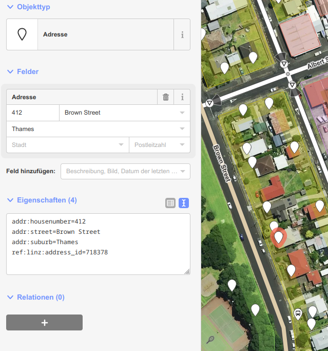
Sometimes the address is not tagged to a node (marker) but directly to the shape of a building. In the side bar you can edit the house numbers but you should be aware that we do not just copy house numbers and other attributes from other maps but check them on the ground to be sure what we edit is correct.
Also copying from other maps (even council maps) may cause conflict with copyright issues.
Any path being visible on the ground can be entered into the map. If the path is not open to the public, this will be made clear by access restrictions, see wiki page
Key:access - OpenStreetMap Wiki
Again it should be checked on the ground if there is any sign or barrier prohibiting access.
Btw: I would recommend to run the tutorial of the map editor if you have not done that so far.
1 Like