I have been mapping underground services in Cambridgeshire, Suffolk and Norfolk (mostly gas pipes which are part of the national networl).
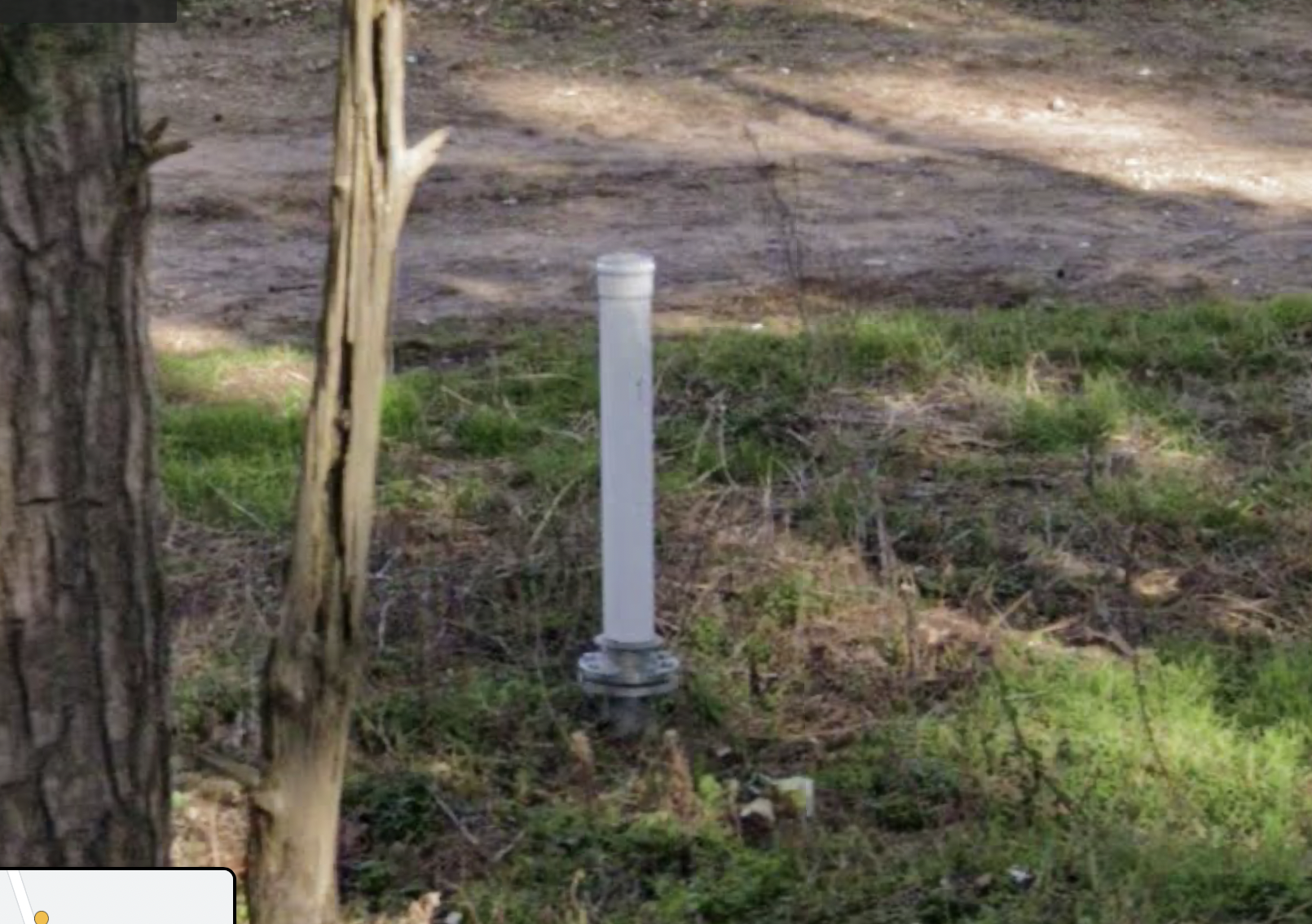
Recently I came across a strange pipe sticking out of the ground just south of Thetford at lat 52.3907204 long 0.7781522 . See it for yourself on streetview here:
https://www.google.co.uk/maps/@52.3907204,0.7781522,3a,64.2y,71.48h,77.25t/data=!3m6!1e1!3m4!1s1Sm1ivpRmbaxeptlpjiJ5g!2e0!7i16384!8i8192. Screengrab at foot of post:
**What is it?
**
I’m almost certain that it is not part of the gas network. It could be part of the GPSS oil/petroleum network, but I don’t think it is. While it could be an isolated “nothing” (e.g. a vent from a cess-pit) there is really no reason to have such a thing in that region. It’s a long way from any other built structure. The whiteness anmd the shiny stainless steel flange that attaches it to the subterranean structure all points to something relatively new. But it’s location is at a gap in the hedges that is usually (but of course not always) associated with a large underground structure crossing the road. (E.g. that’s a sign I see in lots of NTS gas routes crossing under roads — which is how I came to find this pipe.)
There is a possibly similar feature about 1km away – but if it is related the second structure is much older and cruder and painted black, and painted black.
In both cases the pipes appear to be near large pig farms.
My only thought is that perhaps large pig farms have non-trivial underground pipe networks for dealing with slurry or something else porcine related.
Does anyone here have any ideas?