Unfortunatly no. Lambertus was very active in the dutch community but he does not respond anymore and I don’t think anyone knows him personally. So we don’t know what happened and you can assume that this service will not be fixed.
I’ve tried to contact him recently when I got issues with the Wuppertal server (my maps are hosted there too) but unfortunately he didnt respond. Tried several mail adresses and even phone numbers. ![]() Eventually I contacted maintainer of the server in Wuppertal who could help me out, but he also couldn’t reach him anymore. So I assume we have to accept this service is stopped permanently.
Eventually I contacted maintainer of the server in Wuppertal who could help me out, but he also couldn’t reach him anymore. So I assume we have to accept this service is stopped permanently.
However, there is an alternative: https://extract.bbbike.org/
Custom areas, weekly (or daily?) updates, lots of other styles, only garmin device img extracts though (no Basecamp versions).
Thanks for the response.
What i liked a lot, was the design it the bigger symbols like I know in Garmin cards.
I also use the “Freizeitkarte”, and they are perfect, but its hard with the small symbols or Hotels etc…
I will take a look at the bbbike sides.
thanks.
And what I really miss, the selection of the tiles to create a own map.
For example, I travel Russia, Mongolia and the Stans, so I can create a map for this region, and don’t need to download 10 countries and change them on the SD card
You will be pleased to know you can draw your own polygon shape to download a tailored area of your choice using Bbbike.org
https://extract.bbbike.org/
I just tried and found out, this is just for the Device ( in my case Garmin )
I can download img data.
But it is not possible to download maps for software like basecamp.
That was the big bonus on the site from Lambertus.
You can connect your device to the computer, or create a virtual drive and view the maps from there with Basecamp. Another workaround is to use my osmcombiner tool to create one bigger installable map for Basecamp from several gmapsupp.img’s
http://osm.pleiades.uni-wuppertal.de/openfietsmap/OSM_Combiner/readme.html This method has one big disadvantage, it lacks an overview map for lower scales, so you have to zoom in to view the map.
Thanks, thats what I am looking for, to combine.
I will try your tool.
Thanks ![]()
Unfortunately, with http://garmin.openstreetmap.nl/ death, I also found myself with the map problem for my Garmin Etrex.
Every time I find errors on my bike I go to correct them on OSM and then I love to find updated maps on Garmin.
I tried https://extract.bbbike.org/ but with the map size limitation it is not a viable alternative, I found http://www.freizeitkarte-osm.de/ and am starting to try it.
I was also using the .nl maps before but now I have completely switched over to https://garmin.opentopomap.org/
At first it was a bit of an adjustment to get used to the color scheme but I’m loving it now. And more features.
RE: for worldwide coverage on http://garmin.openstreetmap.nl and hope to update these each week
I downloaded country maps .img new style for various in europe in April 2020
I re downloaded the same maps to update my satnav and ALL the maps are the identical size to those which I had from a year ago.
Are these no longer updated please?
thank you
Yes, it seems this service has stopped. See previous posts for alternatives.
Didn’t you read all the post yours?
Hello,
Who know’s what happend to Lambertus?
It looks like that this site is not up to date.
Who can help us?
If you tell what you need we can help you with a alternative website.
As per today http://garmin.openstreetmap.nl/ and osm.pleiades.uni-wuppertal.de/garmin/ is working but maps are outdated (2020, you know, Lambertus MIA/AWOL ![]()
I was trying to get the boundaries and seeas tiles, that are not working. They can be downloaded up to date from
http://osm.thkukuk.de/
CT
I don’t agree.The service used to offer the possibility to select tiles, a very nice way to create a custom map, and this doesn’t work since many months.
Outdated maps is the other obvious problem.
Sorry, my not-precise expression.
Website is up, and, what is offered, works. But custom build maps functionality is gone…
Now not even the simple download of countries works anymore…
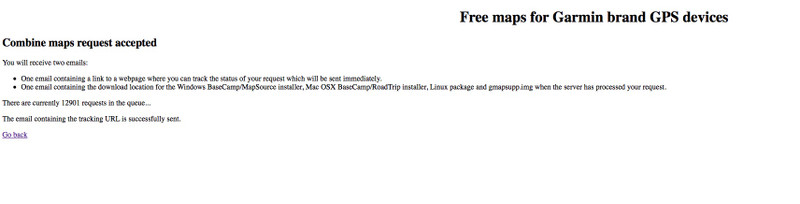
more than 12.000 requests and 54 days in line.
And extending…
At the risk of asking a silly question, what are you actually hoping will happen in response to your post here? That server no longer does what it used to do and its former maintainer is AWOL. Insert whatever quote you like from https://en.wikipedia.org/wiki/Dead_Parrot_sketch.
There are, of course, plenty of other ways of getting OSM data onto a garmin device, either as a direct download or by creating the map for exactly the area you want yourself. (see lots of comments earlier in the thread). They don’t work in exactly the same way as garmin.openstreetmap.nl , but you can download the same data.
The way that garmin.openstreetmap.nl and the other infrastructure around it was set up isn’t (as far as I’m aware) documented anywhere so no-one can just lift it and deploy it esewhere - and even if it was, someone would need to commit a good chunk of time to maintaining it and dealing with user requests.
The next question, given that garmin.openstreetmap.nl is no longer usable, is what do you actually want to do? Perhaps someone can help with that.