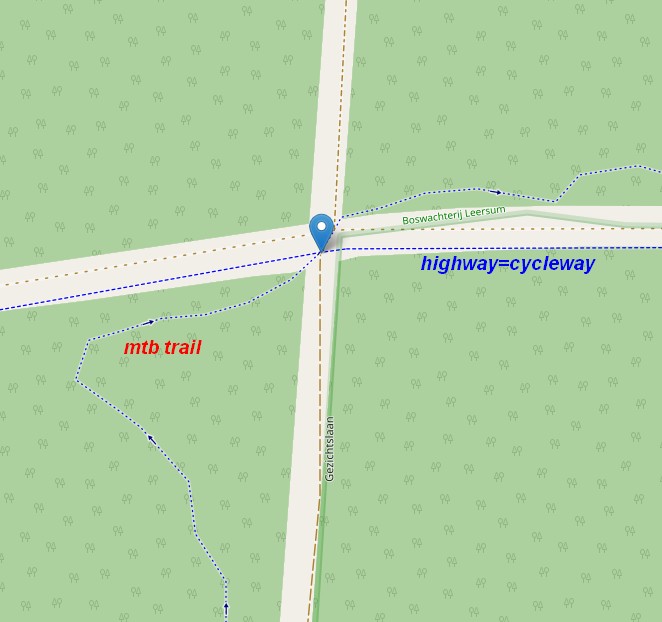
In the Netherlands we are dealing with mtb trails which are only accessible for mtb bikes (often with a permit), but are tagged with bicycle=designated and highway=path. They render on osm (and also on my OFM) as regular bike paths (blue dotted lines) but are totally different. Question is, can Osm carto make a difference and how? Or is it an issue with tagging?
Personally, I would advice mappers not to use bicycle=designated here, but use mtb=designated. IMHO designated does not mean “especially designed for” but that is another discussion. Unfortunately this way of tagging seems widespread and we (as renderers) have to deal with this.
Mtb:scale tags might be an option, but those paths in NL are generally easy (=0) so mappers either dont use this tag, and/or often normal bike paths are tagged with mtb:scale=0 as well if they are part of an mtb route, so I prefer not to distinguish it with mtb:scale (if <1) on my OFM.
Same for an mtb relation, sometimes the route uses general bike paths too which makes it tough to distinguish it for the renderer.
Long sory short, ![]() what can renderers do to distinguish them from regular bike paths or does the way of mapping needs to be changed?
what can renderers do to distinguish them from regular bike paths or does the way of mapping needs to be changed?