Poor Myanmar

If you think Thailand has been subject to poor tagging, take a look at the swathes of new roads that have appeared all over Myanmar (Burma) in the last few months.
I would suspect some form of AI has been used here, as everything new is going in as highway=tertiary, and of course, from a faceless user with no profile.

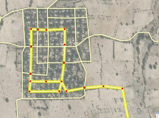
https://www.openstreetmap.org/#map=14/20.3749/95.2372

Zoom in and you will see even goat tracks disappearing into the mountains, residential dead ends… all get the tertiary treatment.

Which brings me onto the point, just what the heck has happened to OSM over here ? How come the community has allowed these massive imports of data into a map we spent so much time to try to get right ?

It seems to me that OSM has been allowed to be used as a playground, and as I have said before, when a mapper sees existing work he is inclined to map elsewhere… so once this AI is in, its likely to stay there. That is unless the DWG look seriously at the quality of work, and do massive reversals on the same scale the data came in.

Perhaps Myanmar wasn’t AI, but given the volume & short timescale in which so much was added, I suspect it was. Most roads I quickly looked at just carry the single tag, with no source info. So now poor old Myanmar really has a useless map as far as Sat Nav goes.

After nearly 10 years of tireless mapping, I’m getting disillusioned with the whole concept now… map your local area was the original concept, not sit in a chair 5000 miles away and enlist a computer to cover a country with roads you know nothing about.

And this reinforces my stance on the earlier thread on living streets … how can we waste our efforts and be so pedantic over the small difference between residential/service/living etc, when closeby we have such massive tagging errors, and appear to be doing little about it ?

Russ.

Two things:
If you had done some research, it turns out this is not AI doing these changes… It’s some presumably Russian iD user:
https://www.openstreetmap.org/changeset/58301637
So - The Occam’s razor again, it’s not an AI, but a clueless mapper the likes of which we had dozens before.
Second thing:
After 10 years of mapping, don’t you know about the Data Working Group?
https://wiki.openstreetmap.org/wiki/Data_working_group

Thanks for the input, although the rebuff is far from constructive.

I am not from a computer background, and can not interrogate OSM to find out exactly the source of the data … I’m a simple guy who rides thousands of km, uploading tracks, then with local experience, plots as best as I can. For this reason I tried to exercise some diplomacy in the knowledge there are hundreds of keyboard warriors ready to pounce, hence my words “I would suspect some form of AI has been used here

We are all guilty of making easy assumptions, and I guess have used your razor to label him as Russian then?

Secondly, I’m fully aware of the DWG and have had a number of exchanges with Andy on both AI in Thailand, and other related matters.

My post was aimed at Asian mappers bringing these edits to attention, and with a view to inviting comment on the major problems we are facing here, hopefully encouraging some Myanmar mappers to reply. If, for the sake of example, Poland, suddenly was invaded with a bulk import of poor quality data, how would you deal with it ?

“Massive reversals” is actually the easy bit, once the problem’s been identified. The tricky bit is figuring out whether that’s appropriate or not, and we need to local community to decide on that. As was discussed a bit in https://forum.openstreetmap.org/viewtopic.php?id=61826 , different people have different views of what’s an appropriate way to deal with this sort of stuff.

That said, it does make sense to say to them “you need to engage with members of the local community”, so I’ve added a zero-hour block here:

https://www.openstreetmap.org/user_blocks/1938

Thanks Andy.

I was not aware that Stephan had already raised an issue with the mapper earlier.
And you are so correct … the decision making process is difficult. For Thailand, the most active mappers here are in conflict over the quality of the FB AI work. I believe all should be reversed, but I readily accept the view of others that its of some value. After all, no one can argue that the hard work of tracing is valuable … its just the tagging we are all concerned about.

Im afraid a clear direction to give the DWG is impossible, unless we can agree locally… and our only chance of that is if “good old Stephan” does something, as most of us look to him as the guru over here. I’m also aware that by now, the window of opportunity has closed as many further edits have taken place since the import.

The same situation applies to Myanmar - lots of tracing has been done, and there is a value to this. So what to do now? I have to be careful as while its a neighbour to Thailand, I have not been there, and virtually never map it bar putting the occasional trace from my biking friends who have. I certainly don’t want to be accused of poking my nose into to other mappers domains, although the problem is similar to Thailand, irrespective of how the data was added.

Perhaps as a stop gap, change all of User 4719341’s tertiary tagging, to unclassified by writing a script. Not ideal, but better than leaving as is. Apart from that, I can’t suggest much more other than to vent my frustration out here :slight_smile:

Hello Russ,

I understand your frustration about seeing OSM quality suffer by the large-scale edits of some individuals or small groups.

I noticed the Myanmar edits when I investigated the drastic increase of “loose ends” reported by my tooling.

http://compare.osm-tools.org/loose.html

As I was just on my way to Chiang Mai I did not follow it up much more than posting on the international list in the hope someone fluent in Russian might help.

https://lists.openstreetmap.org/pipermail/talk/2018-March/080404.html

My guess of Russian speaking is purely based on the reported interface language of “ru” as reported by iD.

I can’t say what happened around mid-April when the loose ends massively go down again. Maybe roads start to get connected to something or it is re-classified to a non-major class.

So let’s hope some mappers feeling committed to Myanmar or Vietnam have started clean-up actions.

As of today the block is still active. Quite strange it is not yet noticed by an account which did dozens of daily edits before.

Stephan

Perhaps I’ll start some clean up of Myanmar in my free time. I know Rico accused me of assuming this was some form of AI, but with no reply from a very active mapper, it adds weight to my argument.
And the style is so similar to the early FB AI …

Roads that were added in a style similar to a rats path in a maze. Random, and in the case above which I took from Rico’s example earlier, at least 4 intersections that should be linked but are not.

So, the big question for Myanmar mappers … whats easier?
a). just delete all the data from this user… or
b). Spend an inordinate amount of time fixing everything he added.
Of course my guess is we go for option
c). and just leave it as it, perhaps fixing some areas occasionally in a random manner. Just how useful the Myanmar is for Sat Nav now, will be very debatable.

And I hope that my constant highlighting on the fact that this AI is not good for OSM, just raises awareness. Perhaps the FB team have gone back and revised things in Thailand. They say they have, but I’m still coming across their errors. Human nature dictates that they had their glory days of the import… nobody really wants to do the boring mundane work of going back and fixing errors.