Dear Facebook team (Digital Globe AI team) … I wonder if anyone else feels like me … in that this massive project has just fucked up a lot of data integrity and quality (in Thailand, at least) in the name of rapid progress to meet your needs whatever they may be.
I mean in real life, I ride a lot in rural Chaing Mai & Chiang Rai provinces, somewhere I doubt you ever visit. Last weekend, to circumvent a village traffic jam, I head down some “residential roads” … and of course, soon ended up in a muddy quagmire in the middle of an orchard. Not a bloody house in sight ! Definitely not residential and not even been marked as unpaved !
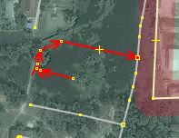
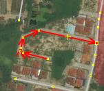
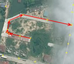
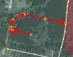
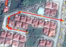
Back on the computer, I see loads of residential roads, running through orchards and fields. Some do connect villages, but are clearly a dirt surface, but in which case our Wiki guidance would say tag as an “unpaved, unclassified road”.
All of which show the AI tag and those dubious user names … RVR006 and the like.
Well Dear Stephanie in Menlo Park, California … why did you do this ? Why not look at the road, zoom in, check its surface, see it runs through an orchard… then mark it as a track, or at the very least, give it a dirt surface.
So where do we go from here … our rural mapping in our region can no longer be trusted, and how long before the data becomes the norm in car navigation devices, and these poor people in their family saloons end up getting stuck in orchards and farmyards.
And then what, the word goes out … “don’t use OSM maps, they are a bunch of crap”. Years of hard human input by dedicated Thai mappers remains useless.
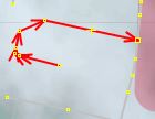
I see in many places, ways connect in illogical places, and simply end in the middle of nowhere because your AI systems dont realise the trees obscure short sections, and simply stop.
Your validation can’t work, because to correct things properly … well that would take a lot of time … as much as we take plotting in the first place.
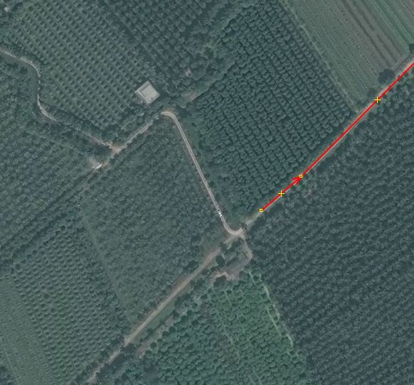
And the accuracy, is arguably just too much … I often see a straight road, which we all can see is straight… having a zillion nodes after its been input by you guys … trust me, when a road is plotted, its much easier to make it straight! A human would see that and not use all those unnecessary nodes, which can only serve to slow and clutter the OSM dataset.
And just what is your motive … you seem to enjoy inputting every road your system generates … but with a complete lack of care for the type of road, its name, its surface, or if it connects. When a human maps, we favour plotting the roads that connect the towns, or go somewhere. We mark the through (main) roads through villages as unclassified, in the hope that navigation systems prefer them … with you guys, apart from a few exceptions, everything just gets banged in as residential.
And that’s not good for the poor residents in these side streets watching lorries get stuck every day … more bad press for OSM.
Stephan takes the time to individually show you how you are failing us … I just see so much bad mapping, Im too overwhelmed to try.
Should I lobby the DWG on reversing EVERY changeset attributed to this “team” ? I’ll await your comment before reposting this in more visible areas of the forum.