Hello Stephan and Dave,
Thank you for your feedback. I was hoping for more local feedback as well.
We completely agree with you on being careful to add small amounts of tiles so we can be sure everything is ok before we move on. We have completed 5 tiles last week and can stay below 25 per week for now. Keep in mind we are also running OSMCHA and Osmose for every single tile in addition to JOSM Validator just to be extra careful.
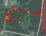
Here is an example of how we plan divide the tasks for the country. The colors indicates the current density of roads going from blue to red for high density areas. Of the 77 province boundaries we plan to start in the Southern Region in the area of Songkhla, same of the sample data we shared.

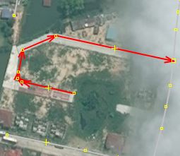
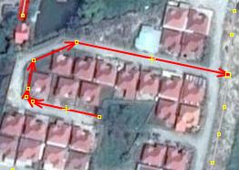
Here is a zoomed in version of the task we plan to complete over the next 3 weeks of May.

As for tagging, as mentioned before, we caution on the side of using a more generic tag and not adding extra tags to a road if we do not have on-the-ground verification. We hope that local contributors can help with situations that are ambiguous or difficult to map as remote mappers.
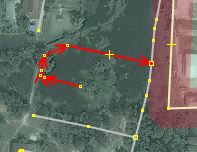
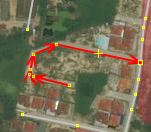
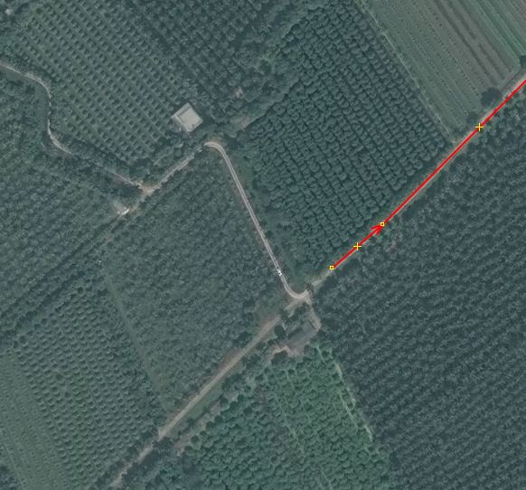
In the examples you mentioned Way: 491189478 and Way: 491189476 you can see in DG it does not go through any buildings. For Way: 491189476 because of the tree cover we could not see if it was a residential road, but can see there is definitely a way, so we decided to go with path until it can be verified on the ground that a car can actually pass. We hope that local contributors can help with situations that are ambiguous or difficult to map as remote mappers.


Lastly, the imagery you see now is not the same as what we are using. I have heard Thailand is on the roadmap to be added so you will see the same high resolution imagery we use by the end of the Month ![]()
Thanks,
Drishtie