Hello Stephan and Tony,
Thank you so much for the feedback! We very much appreciate the time you took to provide us with comments and critique. As remote mappers we have taken a more careful approach when it comes to tagging and caution on the side of not adding extra tags to a road if we do not have on-the-ground verification. We hope that local contributors can help with situations that are ambiguous or difficult to map as remote mappers.
How certain are you regarding the positional accuracy of the imagery you are using?
To ensure our contribution is appropriately aligned with pre-existing OSM data we currently follow OSM guidelines; we adjust the position of the imagery by aligning it to pre-existing OSM data, as well as the available GPX tracks in the OSM database.
The debatable usefulness of certain ‘highway=track’ ways.
We agree. We hope that local contributions, and feedback like yours and Mishari’s, will help us to recognize the most useful tracks to include.
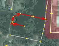
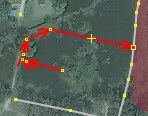
In this case (7.135251457220321, 100.58416959161377) we agree that the small tracks, which are not connected to the main roads, are likely not useful.
Some of your highway=service roads could have additional tagging to clarify what kind of service road it is.
We currently don’t apply additional tags to service roads. Since additional tags for service roads usually describe its use (parking_aisle, driveway, drive-through) we hope that the local community can contribute these details not available to us.
I might have tagged this as a highway=service as it only serves as a way to reach the National Library and maybe another building in the woods.
Thank you. We understand it’s better described with ‘highway=service’. For situations as specific as this, local context is difficult to find. We hope that local contributions can better qualify cases like this.
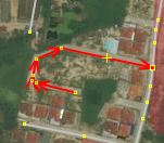
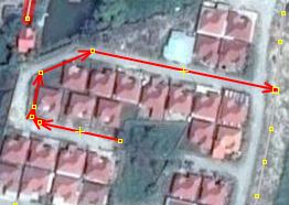
highway=service around something looking like dormitories
This road’s tag was chosen because the surrounding roads are all ‘highway=service’ and contained within a hospital area polygon.
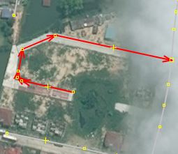
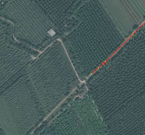
Here around the aqua culture I would have used highway=track. If clearly visible adding a surface=paved tag.
Thank you for finding this! We agree. We would not add the surface tag in this case since it’s difficult to determine paved or unpaved from the imagery.
Here it might be an unpaved residential road. With all those houses and driveways certainly not agricultural.
Thank you for finding this! We agree.
This highway=unclassified does not really interconnect villages or neighborhoods. Could be residential if it is a housing estate. Otherwise service.
Thank you for finding this! We agree.
This feedback is incredibly valuable. We look forward to continuing to learn from your experience and local knowledge.
Best,
Drishtie