Sorry, busy mapping these few days. 
Suburb is not a place outside a distinct town or city. Remember, we don’t follow US English in OSM (confusing, right?). Things are in UK English because OSM’s birthplace is the UK.
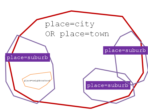
From the Wiki, somehow, ideally… city/town → suburb → neighbourhood. Lines in below diagram does not mean administrative boundaries.
However, place=neighbourhood is compelling because from (recently I referred to) the Wiki,
Don’t know, but it feels… fitting. But the problem is, for example, kampungs (place=villages) in Kedah haven’t been tagged yet. So, probably just me, it feels a bit out of place to put place=neighbourhood.
No. Because if the landuse tag exists, then a boundary has been set for that certain place. Which somehow makes me feel OK to use place=neighbourhood to tag taman perumahan. But definitely I won’t put place=village or place=hamlet because taman perumahan is definitely neither.
I agree, and also all those kampung baru in Batu Caves as well. They’re very distinct, but overlapping with nearby areas. No “boundary” to put things simple.
I think of Bandar Cassia too. Ada bandar kat nama saja, but it’s a huge residential area.
Please refer to the first diagram. And compare to this one:
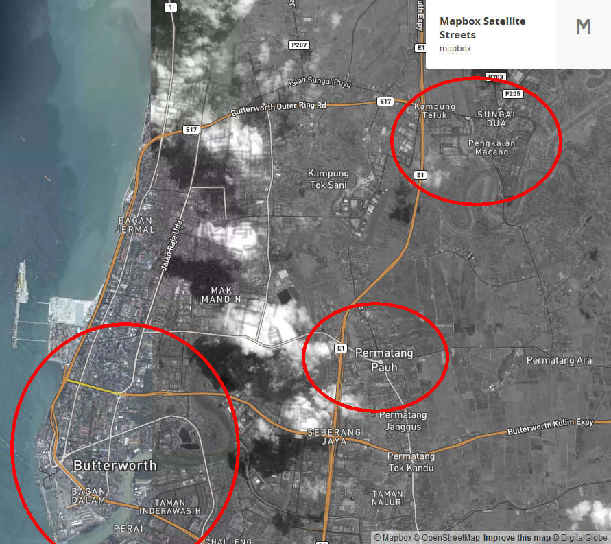
Based on my observations (went there last December), Permatang Pauh and Sungai Dua is somewhat a small town (still place=town). They are separate, not “inside” Butterworth. Bagan Dalam and Butterworth is correct, also Bandar Perda and Bukit Mertajam.