when a border overlapes a street, the street is broken. The street is not recognized for routing. This happens in MapSource and on the Oregon 200 device.
To reproduce the problem:
Look at 15.061 / 46.427 (Rossstrasse in Düsseldorf)
More info:
It happenes, if a way is classified as street and boundary.
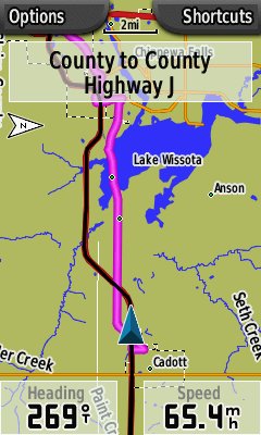
I drove this length of road earlier this week and my gps would not navigate over this portion of highway 29. The motorway has nodes that lay exactly under the nodes for the administrative border for the locality Lake Wissota. I have found smaller instances where a crossing border that shares or overlays a single node with a motorway causes routing problems but this one example seams to show it the best.
How should I best deal with this? Bug report? Shift border nodes slightly?
The map was garmin.na1400.info version 11/19/2009. I enjoy contributing to this project. Thank you.
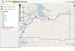
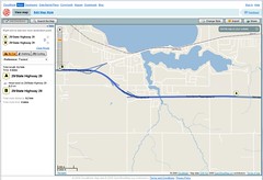
yournavigation.org = no route. I picked 2 points on the westbound lane of 29 and it did everything possible to avoid it.
Cloudmade = yes, routed over it properly.
josm routing plugin would not run on my system. It produced errors saying no node selected.
Unfortunately tiger highway and city border nodes seem to overlap often. This is a fairly rural area so there are not many of us working on these roads.