Is that the only map you have on the Oregon? Oregon’s can be picky. If they have an earlier file with the same mapID or Family ID they might not show the later map.
I have 4 other OSMs on my Oregon. In fact, this presents a separate problem, because they are all grouped into one “family” on the GPS, and thus cannot be enabled/disabled separately. Does anyone have a solution to this - can I rename them somehow?
Despite the presence of other OSM on the GPS, it’s hard to see how this could lead to just one tile out of many being rejected.
Thank the generous person that sponsored the extra server. It tripled the map cache and doubled the map generation speed. The large cache allowed me to disable map expiry on the country maps(which saves CPU power) and increase the custom map expiry period.
Yes, I’m very happy with that.
And to my surprise I’ve got a second offer for a sponsored server which will allow for even more nice stuff (think multiple TYP files for instance). But at the moment I don’t have the time to use that machine. Real life and a new map version that has some difficulties stand in the way.
Hmm, a new map version has finally been successfully generated and uploaded, but now I’m missing a crucial configuration file… Murphy is having fun yet again.
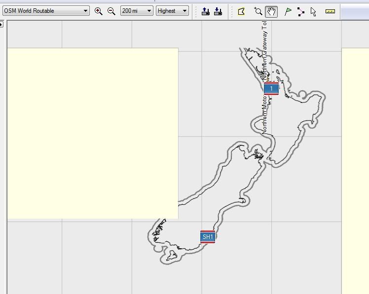
Edit: Fixed that. But what’s up with those two light-blue tiles?
I previously reported that one tile of a download was not showing. I have had a repeat case in a different area, but this time I have solved it. As suggested by Seldom, it is due to a conflict between two OSMs, and is resolved by removing one of them. Interestingly, the “invisible” tile is not one which is shared by both OSMs, but the one adjacent to the shared tile. Don’t know why this is, and I don’t really care. Main thing is, that it is solved!
The only problem is, I still need to rename the maps. I have found the Dutch tool mentioned earlier in this forum, and the developer has kindly supplier an English version called MapRenamer. However, this doesn’t seem to work on the gmapsupp.img files which I load directly into the GPS. What a pity!
Ok I’m not too technical so try to speak in human talk!
Ive been using Lambertus’s maps for a while. I have a garmin scx 60 and I’m using mapsource 6-16-3. I have a windows machine that I was using vista, but have upgraded to windows 7. Since then I can load the maps but I get no detail under about 75miles. I’m thinking its a configuration issue but I can’t figure out how to fix it. I ran something on windows 7 that was some sort of configuration tool but it said it didn’t find any issues.
I used a Lambertus generated map for a portion of spain during a recent travel, and I’ve been surprised to have speed camera warning messages poping-up on my Legend HCx.
Is this an intentionnal feature of the way these maps are generated, and if yes, what mkgmap commands are used to obtain this result?
I’ve had more reports of people who had problems zooming in, but when I try the same map on my Vista install the problem always disappears when zooming in and out a few times. It seems random and never persistent. Have you tried to clear the map cache (hit ctrl+g twice)?
Hey that’s cool, although I never heard of this or experienced this before… You’re sure that you haven’t installed a POI list of speedcams along with the map?
Oops, I checked the .csv file delivered together the POI file I was using and found that it covered not only France (as I needed) but also Spain. Something I wasn’t aware of.
Sorry we are getting the threads a bit mixed up here.
@ligfietser
I tried GmapTool, and it certainly allowed me to change the mapset name. I can now see on the GPS which maps I have loaded, which is a step forweard. However, the OSMs are still grouped together under “family name”, which I haven’t been able to change. This means that I can’t enable/disable OSMs individually - it’s all or nothing.
We’re getting closer, but not quite there. Any more help would be very welcome.
I have a problem creating a custom set. I first tried the prebuild Netherlands map, wich works perfectly. Then, in view of an upcoming travel I constructed a set of the Netherlands + UK and Ireland with a little bit of Belgium. The result of this construction has white areas in Mapsource, it’s like Mapsource sees that I requested them, but they have no content. This includes my hometown area.
Areas I did not request have the generic “no maps” color.
Trying the gmapsupp.img I can see the information missing at my location as well.
Thinking it might be due to user error I repeated the process with a slightly larger area, but the white areas remain.
Maybe this has something to do with parts build on another server not getting assembled correctly into the end-product, or is there some step in the process I missed?