It’s an auto-generated landuse classification created on my own from Sentinel satellite image, so it’s not violated any rules.
I know that geometries look quite rough, but at least it might be better than leave the area empty, especially for low-zoom level. It looks like some kind of roughly-mapped such as many natural=wood around Thailand.
I’m sorry that I forgot to put some fixme or note on the geometries.
I haven’t seen this import guidelines before, so I apologize for not follow these guidelines.
If it shouldn’t be imported, then revert it can be the choice.
Edited:
While waiting for others to discuss this issue, I would explain my work here.
What I’m going to do is to make landuse data available in OSM for Thailand. At least it will make the map look nice on low-zoom level.
My workflow is to generate a landuse classification from satellite imagery with some software, then manually correct some important errors, delete polygons that overlap with the pre-mapped things, and import to OSM with note described as approximately generated.
IMO this workflow could make rough landuse available with low effort. However, it might make some geometries look weird at high-zoom level, but at least it maybe better than leave the area empty, or wait for someone to do the manual-mapping which could take time for decades. (To make it more precise can be the future work.)
I have seen many large natural=wood (such as national park forest area) which are mapped more rough than the result of my workflow. For the reason it can be accepted, maybe it’s about the scale of the polygon. The accuracy error appeared on these natural=wood might be perceived too little in compared with the whole polygon.
If this is the point we have to think about, so I would avoid small polygons to be imported, keep only polygons which are large enough.
So how large the polygon that could be accepted, or it cannot be accepted at all.
I think we might need to be a bit more careful with water features than e.g. farmland or woodland, since areas that appear covered by water will be presumed unnavigable, while roads or paths can be expected to exist that go through cultivated or forested areas. Being roughly drawn shouldn’t be a problem if it didn’t result in a lot of objects confusingly touching each other or overlapping other features (as is the case in several places).
Another concern might arise questioning whether such tagging is really a good idea, since the huge swath of water obscures where the shoreline is on the map. But I’d say this reflects reality; if you’ve been looked out a plane window on approach to Bangkok from the south, the coast of Samut Sakhon and Samut Songkhram really is almost all water. It might be a good idea though to also add landuse=aquaculture, so that it’s clear what these ponds are.
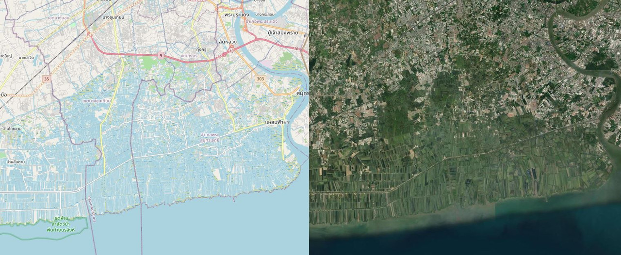
For reference, here the state before revert, compared to aerial:
I think the key points had been mentioned already. The resulting elements should be valid geometry, that means especially no self-intersection or overlap with other features.
The tagging might be tricky as well. Is it all aquaculture? What is mangroves? At least the strip directly at the coast is probably the later. I also wonder whether it is required to try to go to this high-resolution landuse mapping.
The best imagery seems to be 60cm sattelite imagery which frequently has an offset of a few meters between different sources.
If I would spot something like that during mapping I would delete/revert it immediately, just due to quality making harder to fix it than to map from scratch.
With the current imagery and tools, I can’t make it to generate a good shape of these ponds. So I think I should give up and waiting for some better things in the future.
