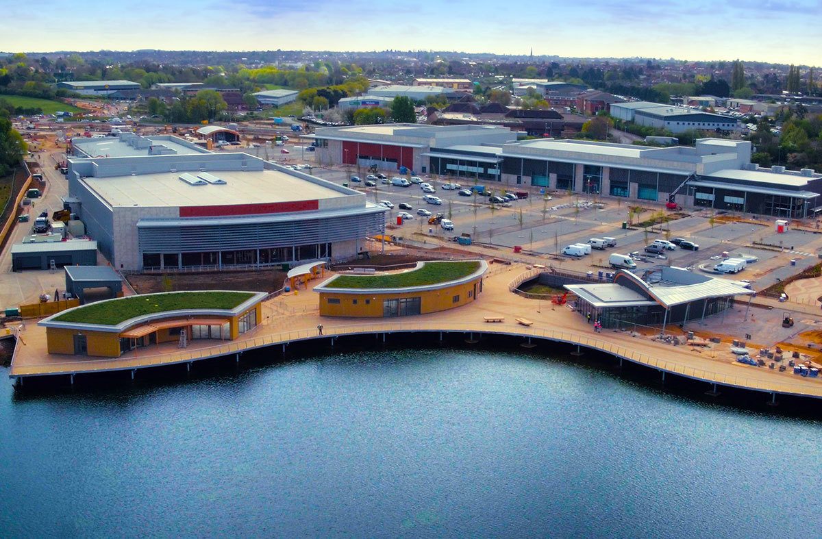
I’ve used a man_made=pier here represent this new development:
The platform above the water is a bit of a tricky one to deal with, at least for me.
Unfortunately the use of =pier seems to have obscured the buildings: a purple area is drawn over the top of them. Happily I have caught the tiles at different zooms/update schedules, so can show a Before and After
I think this is probably something to do with the highway=footway tag that iD automatically added to the pier. Can anyone confirm?
If that is the reason, is =footway an intrinsic property of any pier, and I can’t do without it? (The wiki says otherwise the area would be ‘an island, and useless for routing’ - but I thought footway areas were useless for routing anyway?)
If a pier can do without the =footway tag, would removing it make me guilty of tagging for the renderer? (Don’t shoot me yet!)
The iD preset is questionable and has been mentioned as a potential problem here before, but in this case it’s partially valid. From the photo, it looks like pedestrians can walk anywhere surrounding the buildings and on the pier, so highway=footway + area=yes would be correct. However, those tags shouldn’t be on the man_made=pier area, because they don’t apply to the entire pier (there are buildings in the way). What I’d suggest is making a multipolygon relation that includes the pier area (and any contiguous pedestrian areas on the adjacent land) with the “outer” role, and add the buildings as “inner” so as to cut them out as holes, and tag this relation as the footway area.