Hi,
I’m wondering what is done differently on the (a|b|c).tile.openstreetmap.org server compared to my own installation, regarding world boundaries & coastlines & especially lakes on high (larger scale) zoom levels.
Below is a few screenshots detailing what I mean, the tile on the left is created by my installation of OSM + Mapnik + mod_tile / rendered , the tile on the right is the same tile from OSM server (http://a.tile.openstreetmap.org/6/37/18.png)
My setup is using data downloaded today (osm.xml , mapnik, world_boundaries, processed_p, Planet.osm) and osm.xml has not been customized for the first two example images (other than paths & database logins). Files have been downloaded from the places described at
Why is my map lacking lots of detail (the big lake, coastline detail, scattered little bodies of water) that is visible in the osm generated image?

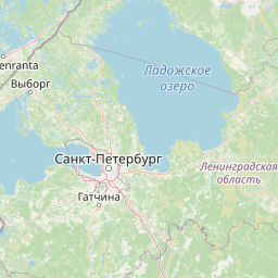
If I zoom in enough, I do eventually get the lake visible in my rendering (again left is my installation, right is tile.osm.org):

Now, I tried fiddling with osm.xml to view processed_p (the more detailed information that does contain the lake) data on higher zoom levels, but I end up with a nasty grid covering the image:
  <Style name="coast-poly">
    <Rule>
      <MaxScaleDenominator>2500000000</MaxScaleDenominator>
      <PolygonSymbolizer>
        <CssParameter name="fill">#f2efe9</CssParameter>
      </PolygonSymbolizer>
    </Rule>
  </Style>

the Grid seems to be made up of line-strings, as changing the style to:
  <Style name="coast-poly">
    <Rule>
      <MaxScaleDenominator>2500000000</MaxScaleDenominator>
      <PolygonSymbolizer>
        <CssParameter name="fill">#f2efe9</CssParameter>
      </PolygonSymbolizer>
       <LineSymbolizer>
        <CssParameter name="stroke">black</CssParameter>
        <CssParameter name="stroke-width">0.2</CssParameter>
      </LineSymbolizer>
    </Rule>
  </Style>
results in this:

Any help / ideas would be appreciated. I’m guessing that the tile.openstreetmap.org servers do not use the same osm.xml or world_boundaries/processed_p data as is described on the Mapnik related wiki pages - but this is just a guess.
Cheers,
Xenic