Could OSM Tags: boundary=administrative (with a place tag), place=locality and place=hamlet be translated into distinct garmin POI type codes? At present, (at least in the new style) they all appear to be assigned to 00b/00. This causes duplication and confusing rendering in some areas because (i) admin areas (with a place=locality tag) and localities are rendered with a dot, whereas they are intended as areas rather than point locations; (ii) an admin area is labelled by default at its geographic centre, which may be in rough topography away from the accessible or populated area locally recognised as a locality, or a named hamlet, which commonly shares the name of the admin area.
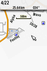
An example is the area around www.openstreetmap.org/#map=15/-28.4976/153.4969
Standard OSM rendering handles it well by showing admin area names only as boundary labels (and only at high zoom), and showing localities as areas (no dot). Admittedly, population centres such as hamlets, villages etc are also shown without a dot, but that works OK in Mapnik.
If these OSM tags were translated as separate garmin type codes, interested users could modify TYP files to eliminate the duplication of names and/or use label types that indicate the feature type.
Suggested translations are:
OSM boundary=administrative & place=locality: POI Type 01f/00 (county or parish)
OSM place=locality: POI Type 064/0a (locale)?
OSM place=hamlet; POI Type 00c/00 (town < 50K)
These features could then be distinguished with TYP entries like:
[_point]
Type=0x00c
SubType=0x00
;GRMN_TYPE: Small city or town center, typically less than 50K inhabitants/Non NT
String1=0x04,Small town
ExtendedLabels=Y
FontStyle=NormalFont
CustomColor=No
DayXpm=“3 3 1 1” Colormode=0
“! c #000000”
“!!!”
“!!!”
“!!!”
[end]
[_point]
Type=0x01f
SubType=0x00
;GRMN_TYPE: County or parish center/Non NT, NT
String1=0x04,County or parish
ExtendedLabels=Y
FontStyle=NoLabel (invisible)
CustomColor=No
DayXpm=“1 1 2 1” Colormode=16
“! c #C0C0C0”
" c none"
" "
[end]
[_point]
Type=0x064
SubType=0x0a
;GRMN_TYPE: Geographical Named Locale/Non NT, NT
String1=0x04,Locality
ExtendedLabels=Y
FontStyle=NormalFont
CustomColor=DayAndNight
DaycustomColor:#838383
NightcustomColor:#838383
DayXpm=“1 1 2 1” Colormode=16
“! c #C0C0C0”
" c none"
" "
[end]
My suggestion is to set all of the above features to appear at about the same zoom level (around resolution = 18 or 19 bits), and not then disappear at some higher zoom levels (as occurs at present for some of these labels in BaseCamp, which may be a law unto itself).
Larger population centres are perhaps already translated into corresponding Garmin POI types (lifted from TYPViewer):
0x00100=Large city with >10 million inhabitants/Non NT
0x00200=Large city center, typically 1M+ inhabitants/Non NT
0x00300=Large city with a range of (2-5] million inhabitants/Non NT
0x00400=Large city with a range of (1-2] million inhabitants/Non NT
0x00500=City with the range of (0.5-1] million inhabitants/Non NT
0x00600=City with the range of (200-500] thousand inhabitants/Non NT
0x00700=City with the range of (100-200] thousand inhabitants/Non NT
0x00800=Medium city center, typically 50K-1M inhabitants/Non NT
0x00900=City with the range of (20-50] thousand inhabitants/Non NT
0x00a00=City with the range of (10-20] thousand inhabitants/Non NT
0x00b00=City with the range of (5-10] thousand inhabitants/Non NT
0x00c00=Small city or town center, typically less than 50K inhabitants/Non NT
0x00d00=City of unknown population/Non NT