Malaysian OSM Wiki pages

Sorry for not making my point clear. Caffeine fix is not kicking yet :stuck_out_tongue: Get ready - I am talking about pedantry.

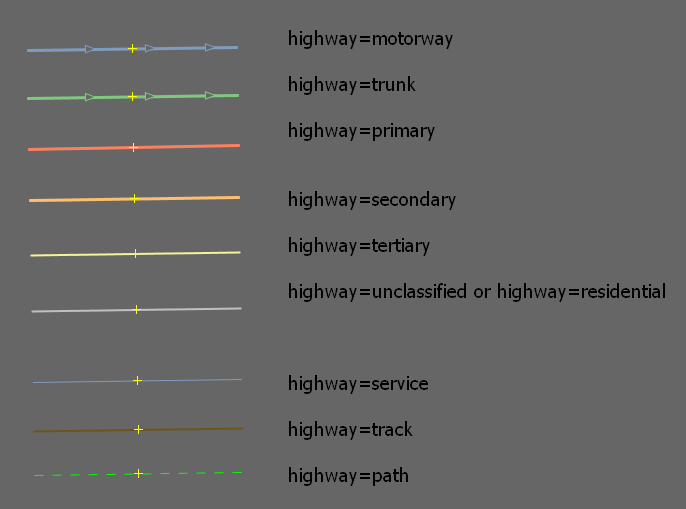
I did not intend to abandon highway=trunk at all. There are some routes that’s really perfect for the tag. Most of them probably can be found in the Greater Klang Valley, perhaps Johor Bahru or some that are/were built by federal or state JKR. However, we must consider those who are potentially international road users that are using the OSM database in satellite navigation systems.

In neighbouring Thailand, from my experience:

  • a trunk road is specified much like the Federal Highway (federal route 2), except there are road intersections with traffic lights (i.e. instead of interchanges with the overpasses) and without toll charges

  • for example, this route (no idea what they are called really) and this one, they are fully divided highways, end-to-end

  • no expressway within sight, and one can find them only near Bangkok

  • major crossroads (three or four way junctions), however, are really few and may not causing a gridlock.

  • no four way junctions with really minor roads (highway=tertiary and lower, perhaps even highway=secondary), there’s only slip roads going into and out of it… I mean much like slip roads along the Malaysian Federal Highway. Let me know if this sounds really vague. This is to control the flow of traffic.

  • controlled access with U-turns are allowed at some certain place

Perhaps I will add more, later, in a new post.

I will include more details later. Stay tuned.

Back to Malaysia.

Federal Highway fits best the highway=trunk tag. From my (limited) observation and experience, these routes simply goes in as well:

  1. Federal Route 276: from the NSE to UUM

  2. Federal Route 194: from the NSE to Arau, then stopped short before Kuala Perlis

  3. Federal Route 176: Jitra to Arau, maybe to Kangar if I am not mistaken

  4. Some parts of Federal Route 5 - they will be upgraded soon as the West Coast Expressway

  5. Without doubt, whole Middle Ring Road 2, Federal Route 28

  6. I have seen some part of the Central Spine Road. That easily goes in unless it is really a short stretch

There are a number of highways in the Klang Valley that I believe deserved the honourable mention to be tagged as highway=trunk… Blame my sketchy memory. Can anyone from Johor confirm the Skudai Highway as well?


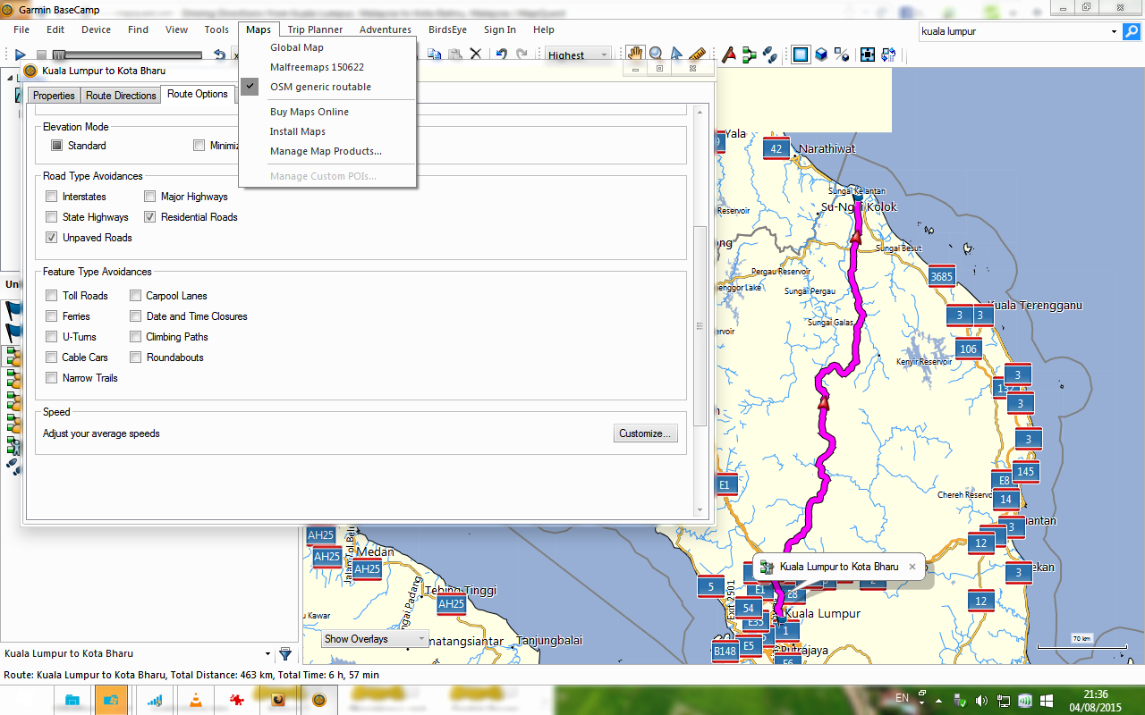
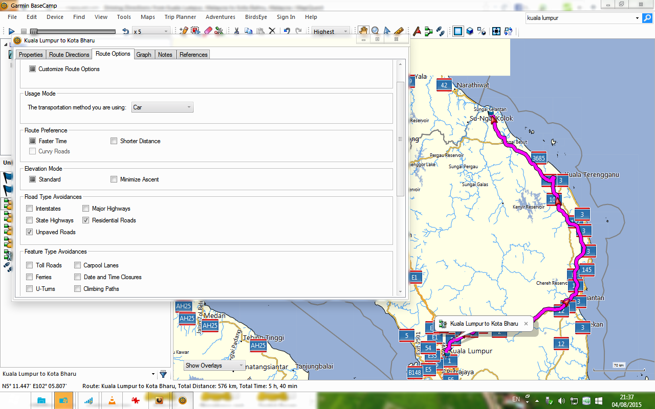
Now let’s focus on both the E1 (North South Exwy) and Federal Route 1. E1 is fine at the moment, it stays as it is - no further amendments. Somehow, I believe E1 influenced how we are going to tag Federal Route 1 end-to-end.

E1 lies close with federal route 1. The trouble lies within the federal route 1. From my experience, most of it stays as a two lane undivided road especially in kampung areas. Only in Jitra to Alor Setar, it exists as a divided highway. The short bit northwards from Jitra, exists as an undivided road and simply merged with E1 through sliproads on the west side only. In fact, a really short stretch (<1km-ish) of federal route 1 in front of Masjid Zahir is indeed an undivided road with paving stones!

Leaving Alor Setar, then it becomes an undivided road as it passed through the villages. Then you will cross into school areas with a 30km/h speed limit. Some zebra crossings intended for the students are indeed in a form of a wide bump - to slow down the traffic. Then you get direct access to homes and buildings next to the road. In short, so many things that can affect the flow of traffic in a supposed trunk highway. Things can be very different in Federal Highway, isn’t it?

As you reach Sungai Petani, the road is split into divided highways again… and similar things follow as you leave Sungai Petani, en route to Butterworth. This goes on and on and on until someone reaches Ipoh, the Greater Kuala Lumpur, etc.

I believe tagging some short part of the federal route 1 as highway=trunk and the rest as highway=primary is unnecessary… unless, there’s a considerable long stretch (like Jalan Cheras in KL) where traffic flow is regulated. It is better to be uniformed in my opinion. Consider the routing machines as well, some may stick to some kind of a road with higher classification in order to cut short the time of a journey.

Based on my limited understanding, there are 2 purpose for this hwy tags. (maybe more…i only know 2)…

  1. cartographic map display - all road class are displayed nicely on the map with 1 color for different class
  2. routing purpose - routing software will find the hwy and trunk roads to connect long distance destination like JB to Kota Bahru, so if the tagging are incorrect, a long route may be generated.

Based on these understanding, Trunk road tags cannot be broken due to lower speed limit and less number of lanes. There’s speedlimit and lane count tags to take care of that.

Only by sticking close to the original OSM spec and best mapping practice, the data will be good for use. Because the GPS software developer will first look at the data spec and develop the software. There are many softwares out there and eveyone has their own logic and algorithm so they have to follow OSM data spec.

Some of my observations(its debateable…)

Penang Island shouldn’t have any Trunk roads - the 2 motorways - Penang bridge 1 and 2 connects to the island. The main island roads should just start at Primary, Secondary, Tertiary & Residential.

UTM sekudai campus roads are tagged too high with secondary and residential, should just be tertiary (no pun intended) and residential roads.

Federal Highway should be motorway because its toll highway. all Klang valley highways like DUKE, AKLEH, LDP, SPRINT, LAKSA, LEKAS, LAMBAT,BLAH, BLAH, BLAH…must be motorway.(follow OSM spec)

Ah, your reply makes me remembered that the federal JKR itself has its own definition for a trunk road!

Did you mean, there should be a continuous segment if we are going to set a highway=trunk tag? That is why I am really close to downgrade most of (the kampung segment) Federal Route 1 to a highway=primary tag. Please correct me if I got you incorrectly.

That’s what we are going to achieve through setting tagging conventions like this topic. During my early days of mapping, I did a lot of mistakes - I tagged roads one more level higher.

There’s Jalan Sultan Azlan Shah viaduct, federal route 6. At least, that part is suitable to be tagged as highway=trunk. The rest of the road, as long as access controlled is maintained (e.g. few traffic light, four-way junctions), IMHO, it is not worth to be downgraded as highway=primary.

Most part of Federal Route 3113 IMHO stays as it is (as a highway=trunk) due to partial access control especially from the Penang Bridge to USM / Gelugor northwards and just to the south of Batu Uban - aiya, sketchy memory, sorry aaa. But then we have to confirm with Penang mappers. Apparently they have their own proposed tagging guide as well!

That, I blame those UTM student mappers. :laughing: :laughing: I am unable to reach them early, and in an absence of a helpful guide, that is expected.

Now that is one interesting discussion. highway=motorway somehow relates being an expressway.

Federal Highway however (I can get very wrong) has access to many interchanges and you also have a number of left-in, left-out ramps. In addition, somehow, the stretch where people do not have to pay the tolls can get really busy, compared to the other expressways. Although it is clear that Federal Route 2 is managed under PLUS, it is not listed under the Malaysian Highway Authority as one of the expressways (aiya, not the blurred lines again between what the authorities say about expressways and highways in general - it makes me snap). Well, regarding this matter, perhaps we need more input. Again, it is not *MY *guide, it is the conventional guide…

The other expressways have well-spaced interchanges, emergency phones, etc. Also, one key word to take care of: road access control. There is a blog of a Malaysian road enthusiast explains things quite detailed with details on JKR road standards.

E11 LDP however, I came across this post from the same blog author saying that it is really congested for an extended time, due to so many left-in left-out ramps from neighbourhoods just lying close to the route. Personally I think his arguments are sound - and if there are mappers who sides with him - I would gladly downgrade part of E11 to highway=trunk. It loses the *express *quality to be an expressway due to local traffic branching in and out.

Now what about an undivided, two lane stretch of E26 South Klang Valley Expressway? I believe, as strict access control is still there, in fact you cannot even make a U-turn… this stays as an expressway.

Not in the Klang Valley but E22 Senai Desaru Expressway is the same thing for the bridge across Sungai Johor.

Disclaimer: I am not the blogger - however I hope I could use his data (pictures especially) for OSMers to include into the map database.

  1. the cartographic map display effects of trunk and primary.
    Route 1 is trunk until Bidor then turn to Primary.
    not saying this is wrong but its not the ‘best’ practise of the mapping industry.
    so in terms of international users, this needs a bit explaination.
    well it does makes the map more colorful…but is this what we want ?

  1. routing effect

compare 2 maps - mfm and osm on garmin.
set same routing option parameters.
start point: Singapore city centre
end point: Kota Bharu city centre

osm route: exit by Woodlands > Kota Tinggi > Mersing > Pekan > Kuantan > E8 > KB (700km)
mfm route: exit by Woodlands > Yong Peng > Segamat > Muadzam Shah > Gambang > E8 > KB (726 km)

both routes are correct but why different ?
maybe due to different highway tags ??
or maybe there are unconnected roads or missing road segments ?
maybe there’s speed limit information in the road database ?
which one to recommend to foreigner tourist ?

just throwing questions to the floor for discussion…:slight_smile:

what i mean is continuous Highway=trunk tag.
segment can be broken along the way but the tagging must remain consistent.

you have to break the road segment when there’s change of speed limit, change of lane, overhead height clearance etc etc… but the change of speed limit doesn’t change the fact that the road is The Trunk road.

take a look at Thailand road from Bukit Kayu Hitam to Haadyai.
the Trunk road tag is not broken. even though it pass through Sadao town.
I sure this route passes through many villages, schools, narrow roads, cattle crossing…etc etc :slight_smile:

So… we are not tagging expressway because of traffic jams? Isn’t that akin to tagging to specific renderers?

When there are too many exceptions to the trunk tag specification, perhaps we should consider abolishing it all together and deal with it. From my basic understanding, the diff between trunk n motorway is minor (existence of crossroads), while everything else remains the same, especially controlled access. If you apply controlled access specification strictly in tag determination, then a lot of what we call trunk hiways become invalid. Motorway also doesn’t mean it is tolled.

By the way, quite extensive portion of highway 3 is being transformed to divided road. (i.e Dungun to KT, Pekan southwards, JB area)

how’s these 2 routes from KL to Kota Bharu?
any takers ? :stuck_out_tongue:

I actually want to avoid tagging for the renderer - I will provide visual clues later. Sorry, I am a bit exhausted tonight :frowning:

This is how the OSM database would appear in Garmin BaseCamp - and also its suggested route for KL - KB. I have to tweak the avoidances a little bit, or otherwise I would get a meaningless straight line from KL to KB.


Rant: I like how Garmin BaseCamp interprets how the federal routes are at the same level with the expressways…

I will give further comments later, probably tomorrow the earliest.

When you compare routing with different maps, please bear in mind that OpenStreetMap data of Malaysia are still very linited - MFM has far more data.
Also note that a routing algorithm needs some speed data - and most map makers in Europe use typical European speed limits as the applicable routing speed (90 or 100 km/h on primary and secondary if no maxspeed data are given). That’s often not useful even in Europe, but some people oppose pragmatic solutions: “maxspeed:practical” is “subjective” and cannot be used because everyone will interpret it differently… I guess in 2 or 3 years they’ll become more reasonable - but data for applicable speeds on Malaysian roads are not yet available.
Getting back to the issue of highway tagging, I think that “motorway” should be used for access-restricted high-speed far distance roads (even if the speed may sometimes be terribly slow due to traffic jams).
“trunk” is physically similar to “motorway”, but without access restrictions. The road from Hatyai to Changloon on both sides of the border is a “trunk”. As junctions of South-East Asian roads differ severly from junctions of high-speed roads in Europe, we should not over-interprete the “junction-free” character of the roads.
Sometimes, some sections of a trunk do not yet fulfil the standards for a trunk - then use “primary” for those sections instead. E.g. Thai road 4 from Trang to Phattalung was not yet a trunk in Dec 2011, but when I travelled along there in Dec 2014, there were two - sometimes even three - lanes for each direction (plus a wide shoulder for mopeds and bicycles), and the carriageways were physically separated.
As for minor roads in the hinterland, I often use “unclassified” for roads which connect hamlets (small villages) - that’s the tag I’d use for such a road in Germany, too.
Malaysia:

http://www.panoramio.com/photo/101636479
Germany:

http://www.panoramio.com/photo/121928245

Thanks Bernhard for your input.

First of all, as promised, I would try to explain the ideas regarding access control (according to my understanding) in Malaysia. Sorry, this took some time. I was being under the weather and also it’s thunderstorm time at my place as well.


From the Wiki,

Full access control is usually seen in expressways. Our expressway system lets every kind of vehicles to access the route, but not bicycles, heavyweight machineries etc. Also, it allows drivers to pull into (or out of) the route through designated exits only. Furthermore, there’s emergency phones, wide hard shoulders, 110 km/h speed limit, etc. Tolls may be collected etc… The road is designed to cater long-distance journeys. No direct access to insignificant building or properties at all. No such thing as crossroads.

This is basically the long description, condensed into a diagram. Obviously it is simplified a bit. It is the East Coast Highway (expressway route E8). Click to enlarge. Not to scale!

I believe no changes will be made regarding highway=expressway in the Malaysian context. Everybody has strong but similar opinions.


A road with a partial access control may look like the expressways in appearance. However, these roads may allow more kind of vehicles to use them (even bicycles). In addition, their designated speed limit is probably not 110 km/h, maybe up to 90 km/h. Maybe toll collection is made between a certain part of the road. Both interchanges and interchanges (with traffic lights) is possible but not too many. These roads may be very important to long-distance journeys. For very local journeys, the routes may not be so important. One can make a U turn at designated places only. Access to properties is possible, probably through highway links.

This description fits the Federal Highway (route 2) very well. Let me know if my observation is incorrect.

The condensed diagram is based on Changlun - Kuala Perlis Highway (federal route 194). It is already being tagged with highway=trunk. Hopefully the proposed Malaysian-style highway=trunk features may strictly follow this kind of description. Bright teal (blue-ish colour) nodes are tagged with traffic lights. Once again, not to scale!

As an additional info: route 194 is much like that, from end-to-end. For Klang Valley mappers, one can think of the Federal Highway or the Middle Ring Road II.

From the Wiki,

But there’s also this description:

According to the international equivalence segment, I can see a lot of divided highways (or double-carriageways) is included the description.


Then we have roads lacking access control. Much like the rural part of the Federal Highway 1 - see below. Every kind of vehicles can use the road. More freedom for road users to turn towards whatever direction, wherever they like. Access roads to properties may be directly through small feeder roads from the main road. This is only possible for single carriageways (or undivided roads). Junctions may even not controlled by traffic lights; and many more…


Basically, this is Federal Route 1 in Kedah, please refer to the attached diagram. Again, that bright teal (blue-ish colour) nodes are tagged with traffic lights. North is on the left and as usual, not to scale!

Malaysian road users are aware of the nature of such federal trunk (this term is being used by JKR themselves, roads with single-digit reference usually), but international road user may not. If they are coming from Thailand (or Singapore), it is way different. In fact, let’s say, it is mentioned that “U.S. Highways are mostly primary”.

The rest of the Federal Route 1 stretch, outside the northern region, are still being tagged as highway=trunk - so not uniform.


It’s not like we’re going to tag roads based on traffic jam - my bad, I probably decided to use a misleading term. It made my statements sound too oversimplified, perhaps maybe wrong.

Edit: “legend” of the diagram is as follows -

yes, I tag for the renderers.

  1. I am ol’skool - still use Mapsource with Lambertus osm garmin map. At zoom level 15km, map only display motorway & trunk so you can see isolated strands of trunk roads, sad to see the proud Federal route 1 in this state :open_mouth:
  2. most default routing algorithm will only consider motorway and trunk roads for long distance routing - there’s no motorway or trunk between Bentong and Kota Bharu - hence the round trip recommended by OSRM.

I find the US explaination easier to understand: http://wiki.openstreetmap.org/wiki/Highway_Functional_Classification_System

just wanna add…

in routing software…road class or highway tag (osm terms), is used to find the ‘fastest’ route.

some may argue, routing software also provide ‘shortest’ route option,
trust me you don’t wanna use this option for long distance routing.
once I got tricked by garmin…KL > Segamat - usually takes me 3.5 hours but follow shortest route…took me 5 hours!!!

Fastest - KL > Simpang Ampat > Tampin > Gemas > Segamat (distance = 191km)
Shortest - KL > Seremban > Kuala Pilah > Rompin > Gemas > Segamat (distance 181km)

lucky car didn’t break down in middle of oil palm estate…fainted…:lol:

That generally holds true also in Europe!
And beware of the fact that an algorithm for shortest time need not actually do what you expect it to do. See e.g. my experiences at http://www.mkgmap.org.uk/pipermail/mkgmap-dev/2014q3/thread.html#21825

Exactly, that’s where I see currently big issues: “trunk” which are actually primary (or even less). It’s not only #1 (which is a trunk for some sections, e.g. near Taiping), but also many other roads. What about #4, #5, #67, #76, just to name a few in the North-West.
Oh, #67 near Baling seems to overlap a different road at the same place (already sent a message to the mapper)…
And then downwards, “primary” which ought to be secondary etc.

@AkuAnakTimur: I recommend you replace the current wiki page with your work. We’ll then see how things develop.

I give another week or so for further amendments. :smiley: After that, I will replace the current wiki page.

further reference for my post #11.

http://wiki.openstreetmap.org/wiki/Osmose/issues#1120

Please let me know if I misunderstood you. From your provided link,

From post #11,

I am not able to confirm that all highways in Thailand being tagged in OSM as highway=trunk will feature stricter access control.

From my experience, the road (number 4) is divided (double carriageway) even it crosses towns, villages, (schools, etc.) from Sadao up to Hat Yai. But the way Thailand OSMers map a trunk road in such convention may relate to the degree of access control. I can confirm the case (so far) with road number 43 (tagged as a trunk).

[Interesting side note: In fact there is a cattle crossing sign that can be found in the North South Expressway, where the Federal Route 1 begin to branch off (or merge into) the expressway, somewhere near Changlun, Kedah]

Road number 42 is quite interesting - there is a mix between highway=primary and highway=trunk. Went there this January, and where and why it should be tagged that way kind of makes sense. The parts being tagged as highway=primary is so because even though it featured 4 way lanes, there is no central reservation (simply put it is an undivided highway) - therefore lack of access control (a driver can merge with the traffic anywhere s/he likes). The rest is tagged with highway=trunk because it is a divided highway plus more access control. Which means only traffic from major roads meets at certain key junctions. Traffic from minor roads strictly follows one direction only - if one intended to go to the other way around, then s/he is stuck with the specified way before making a U-turn, etc.


Now, coming back to our Federal Route 1, as it comes close to the Greater Kuala Lumpur area, I have no problems if we agreed to tag it as highway=trunk. For example, look at Jalan Ipoh (near Rawang), Jalan Kuching (there used to be a toll there isn’t it?), and Jalan Cheras. Surely they are divided highways, and as a Cheras resident between 2008-2010, there is quite a degree of access control (for the case of Jalan Cheras itself - the parts not being upgraded into E7 Cheras-Kajang Highway).

On top of that, I would like to take the chance to blame DBKL for not putting up highway shields in their area of responsibility. Federal Route 1 “disappears” in the middle of KL!

Butterworth can be tricky as well. According to Wikipedia, there is quite a big chunk of the former Federal Route 1 is being upgraded into an expressway. Beyond that, I would be very happy to tag the rest of Federal Route 1 if there is lack of access control, etc.

From the outskirts of Sungai Petani to Kepala Batas, Federal Route 1 is simply an undivided highway. Quite really windy as well, unlike E1 North South Expressway just a stone’s throw from the road.

Ipoh is a bit of mishmash, but easily Federal Route 1 can be beaten by these highways sitting next to the PLUS Highway. The road appears to be under JKR maintenance - with blue road signs.

I haven’t set foot near Johor Bahru yet, but I will let (the most part of) Skudai Highway as it is. I might be tempted to change its tag at the point where the road starts to lose its access control.

Why so? The peninsular has a quite extensive expressway network (highway=motorway). It overshadows the road network built by JKR (or Ministry of Works) by a large margin. I mean, why bother travelling on a single carriageway with up to 90 km/h speed limit when the expressway offers at least two-lane double carriageways, fewer sharp bends, 110 km/h speed limit (etc)? (Tolls aside - hopefully by 2040-ish there will be no toll charges)


IMHO, letting a certain stretch of Federal Route 1 as highway=trunk is OK because, reasons (mentioned above). The rest of Federal Route 1, again, may not offer a strong reason to keep it as a highway=trunk (according to me).

Tagging consistency is important (coming back to your point). However, comparing how the highway=trunk tag is being used at a larger (global) scale, somehow, we (as Malaysian mappers) could… er, “follow the standards”.

To summarise, beyond Bangkok, there’s hardly highway=motorway; but highways with highway=trunk are of a certain access control. The rest of the highways are not so - they lack access control.

Also consider Singapore as well. There are only 3-4 highways being tagged with highway=trunk for the whole island. In their Wiki, it is explicitly mentioned that highway=trunk is for semi-highways.

Brunei has only one highway with highway=trunk.

:laughing: But then again, I am not a tagging police. :laughing:

Revised guide is now up. We can still continue discussing to sort out issues about it here. I will move to another tagging aspect.