There is an old proposal:
http://wiki.openstreetmap.org/wiki/Proposed_features/Street_area
Use: http://taginfo.openstreetmap.org/compare/area:highway/landuse=highway/area:highway
How may it look after rendering?
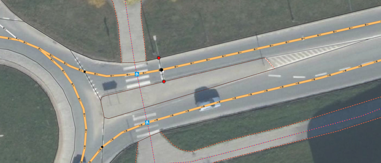
Solution from user Marimil and others from Poland:
http://osmapa.pl/w/area/?lat=53.43287&lon=14.54832&zoom=19&ol=AB
Solution from Russia:
http://openstreetmap.ru/#map=18/55.74792/37.61119&layer=K
Solution from France:
http://umap.openstreetmap.fr/de/map/areahighway-karte_21256#19/51.05140/13.74733
Yo can do it, if your area have good images for precisely mapping.
E.g. Poland: http://wiki.openstreetmap.org/w/images/a/a5/MarekGUGiKBackgroundInPoland.JPG