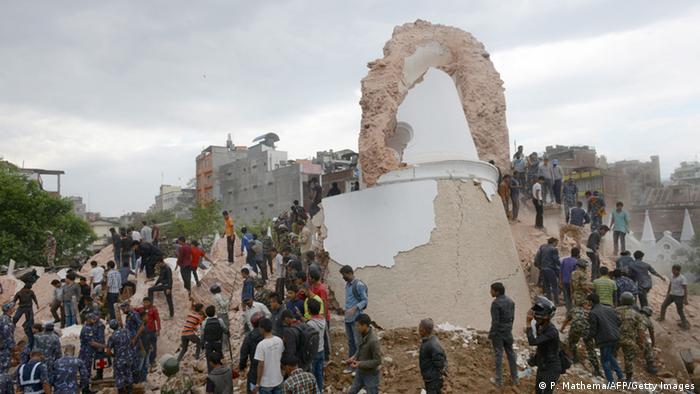
Shit from UK newspaper, “Earthquake mapped in 48 hours”
Anyway, they write about OSM:
http://www.wired.co.uk/news/archive/2015-04/28/mapping-nepal-after-the-earthquake
На територии Непала 12 часов назад замапили 3,5 миллиардную точку
I see that the helper in Nepal very seldom use tag: place=village and place=hamlet.
I use in Nepal place=hamlet for settlements with 10-12 buildings, if more, I use village.
Map of Nepal before and after earthquake:http://mapgive.state.gov/projects/nepal/
kisaa
May 7, 2015, 2:03am
64
Эти деревни. Cпасибо iWowik.
wowik
May 12, 2015, 8:47am
70
We have in this epicentrum area also missing information in the map, especially forests.
http://www.openstreetmap.org/#map=13/27.8036/86.0664
There is a new HOT Task after the Earthquake from today:
http://tasks.hotosm.org/project/1046
wowik
May 12, 2015, 4:42pm
73
Here : http://tasks.hotosm.org/project/1046#task/603
Best regards,
I´m tired ater long mapping; coud somebody of you draw the forest here: http://www.openstreetmap.org/#map=16/27.6893/86.1348
Thank you!
Thank you all!!! This statistic for Russian help in Nepal is impressiv: https://twitter.com/AhmedLoaiAli/status/599206255387893760
This area is very poor mapped:http://www.openstreetmap.org/#map=13/26.9388/87.3368
Regards,