Dear friends,
I see, many cities in Finland have no boundary=administrative with admin_level=8.
See:
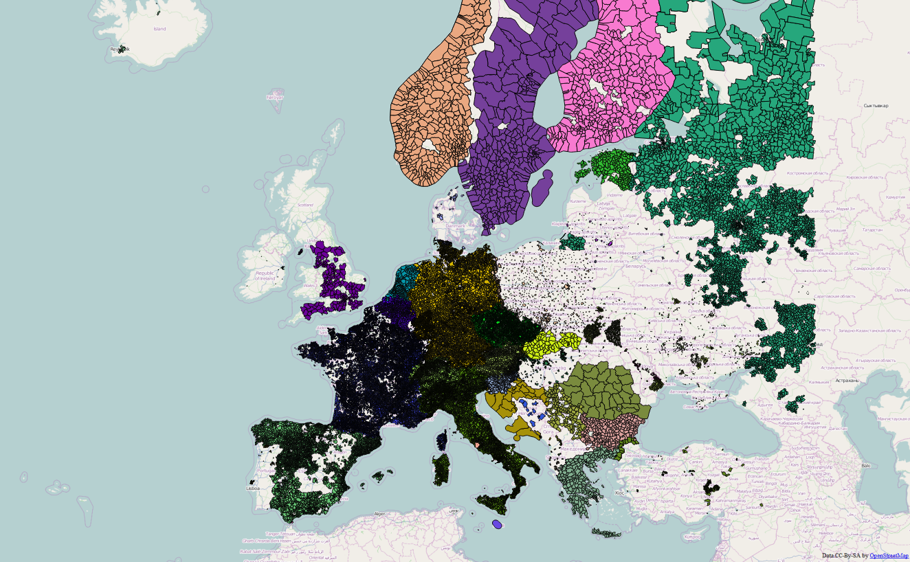
https://wiki.openstreetmap.org/w/images/0/01/EuropeOrder8Coverage201408.png
What is the reason for?
Best regards,
Marek
Dear friends,
I see, many cities in Finland have no boundary=administrative with admin_level=8.
See:
https://wiki.openstreetmap.org/w/images/0/01/EuropeOrder8Coverage201408.png
What is the reason for?
Best regards,
Marek
Well, I guess that those boundary relations are broken and nobody has paid attention to fix them. Maintaining boundary relations in OSM is frustrating and at least I feel too lazy for that. Those who want to get Finnish municipality borders for some professional or otherwise mission critical use probably download them directly from National land survey as valid polygons through the web service https://tiedostopalvelu.maanmittauslaitos.fi/tp/kartta?lang=en. The license is also more flexible that way. Broken municipality relations are naturally bad for global OSM usage but it may well happen that some day someone will fix them. Next day they may be broken again but that is another issue then.
Thank you JRA.
Do we have any tools for semi automatic control / repair of such elements?
There are validator tools, and also some map translators, such as mkgmap, can detect some common problems with boundary or multipolygon relations. But, I guess that they cannot warn about missing data.
Ideally, I would guess that boundary relations should cover all of the Earth surface. If this assumption is valid, it would be possible to develop a validator that complains about ‘holes’ in the boundary data. There could be some legitimately missing boundaries on international waters, though. And there will probably be some overlapping boundaries in disputed areas. One solution could be to analyze the output of the validator tool, and to construct ‘whitelists’ for ignoring these issues, so that edit wars can be avoided.