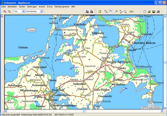
After playing around with the different tools for map generation, I found some ready-made maps (openmtbmap.org) that suite my needs very well for most of the time.
However, for vacation trips I’d so much like to generate some maps that show oceans in blue. I am aware that mkgmap is not capable of this yet, but would it be possible to create transparent maps that show Garmin’s basemap underneath or doesn’t the Garmin system work this way?
Another approach for small areas might be manually adding the sea polygons, does anyone have experience with this?
I know I know, I’ll notice where land ends when my feet get wet, but in my experience (having worked with old-fashioned paper maps for years) it facilitates orientation a lot when I can easily recognize the shape of islands and coastline.
Work is being done on Mkgmap to automatically add sea polygons. So it will probably not take too long before you see this showing up in about every Garmin map…
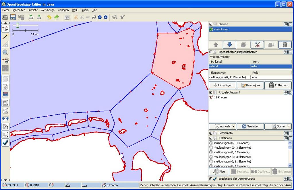
The polygons are created in JOSM as natural=water. For the islands I use multipolygons.
But some islands on the map are flooded when zooming in. I manually split
those MPs to normal polygons.
The objects in my polygon file all have negative IDs so that they are completely
separated from the server-data and I can merge the data with Osmosis together
with the germany.osm file.
Before merging I use the “sed” command to replace “water” with “sea”
and use the --sort option of Osmosis to sort the IDs.
The merged OSM file is then processed in the usual way (splitter, mgkmap).
Thank you for your hints. After some efforts I realised that when dealing with a country that is said to have more than 1.000 islands, it might be a worth waiting until mkgmap is capable of drawing the sea polygons rather than do it manually here.
Now my more modest goal as a temporary solution is to
make the background show up in white (it was partly that pale yellow color that I could not stand where I expected to see blue), and
increase the width of the blue line indicating the coastline.
So, I’m trying to gain some understanding on Garmin typ files.
Together with contour lines, this will hopefully give me some reasonably good overview.
Yea, thats right and of course before drawing the seapolys by hand I already played a little bit with this option, with
bad results. But hopefully its improving in the near future…
In my first test (map of a single, reasonably small island, hardly any other features) created with version 1200 it actually worked like a charm. The map now looks exactly the way I wanted it. Big thanks to the mkgmap developers!
should not be possible in the Typ file, at least my Garmin does not allow me to change the color of the background ID 0x4b. What you need to do is remove the background completely with the --transparent parameter for mkgmap, create a map-sized rectangle yourself with another ID and set the color for this ID.
I didn’t realize mkgmap supported TYP files. If it’s a mkgmap thing, could someone please give me a link to how to do it. If just uses cgpsmapper, I can figure it out.